 View full comparison
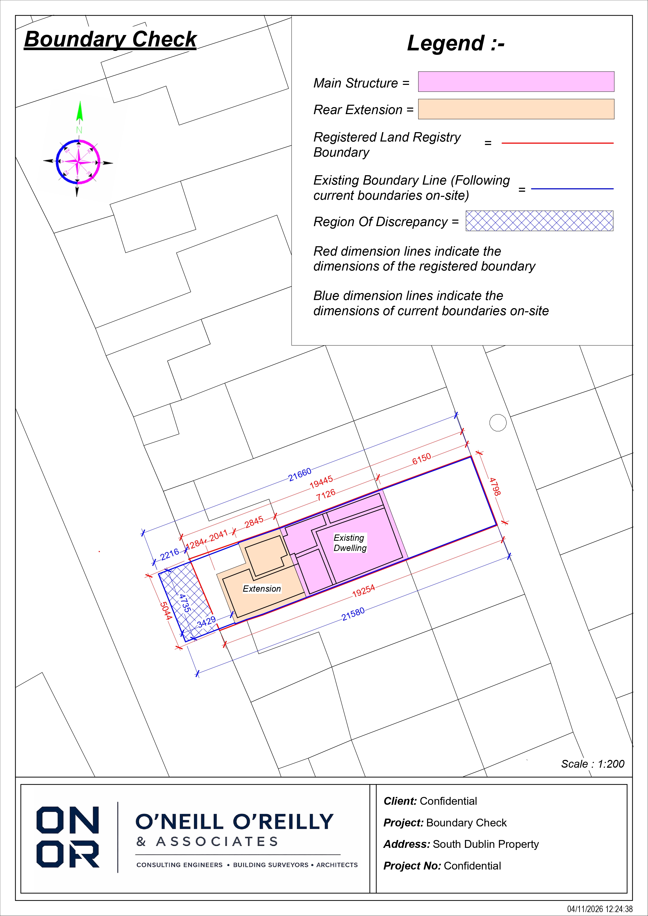
EXAMPLE 01 / SOUTH DUBLIN
Site boundaries compared.
Registered and on-site boundaries shown together, with dimensions and a hatched area highlighting an apparent discrepancy.

Optional checks that connect the physical property with the records behind it, using 3D spatial capture, photographs and document comparison.
Our Boundary Check uses 3D spatial capture, generated with mobile LiDAR scanning technology, to document the site’s dimensions and visible physical features.
We compare those on-site measurements with the relevant registered boundary mapping and OSi mapping supplied for the property, looking for discrepancies that need attention.
Request a Boundary CheckA compact reference bringing the captured site details, mapping comparison and highlighted discrepancies together in one place.
This check identifies apparent discrepancies. It does not determine legal ownership or resolve a boundary dispute. Findings depend on site access, capture conditions and the accuracy and scale of the mapping available.
Examples from previous Boundary Checks show how site measurements and registered mapping are brought together, with apparent differences clearly marked.
View full comparison Registered and on-site boundaries shown together, with dimensions and a hatched area highlighting an apparent discrepancy.
 View full comparison
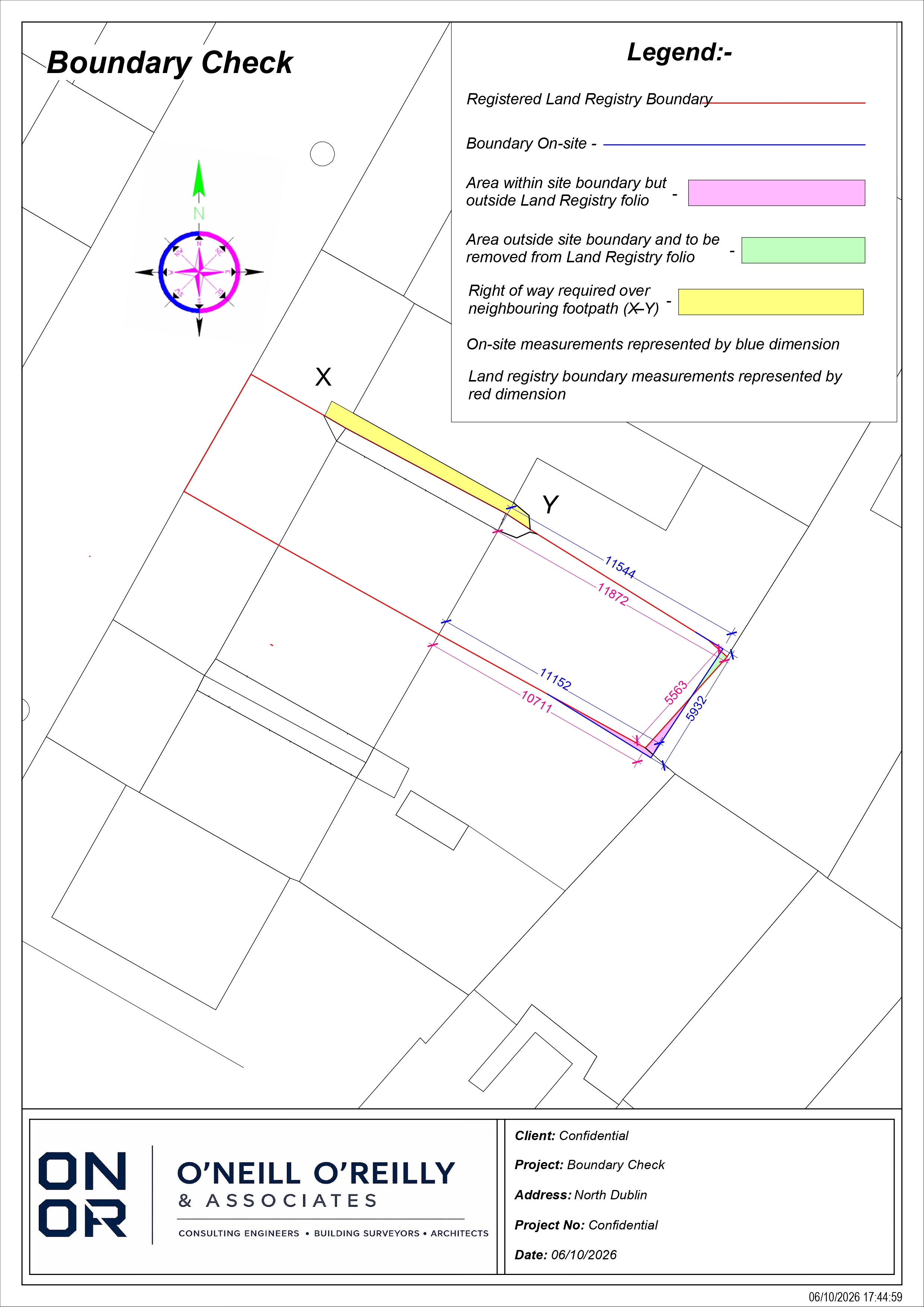
Colour-coded areas show differences between the site and registered mapping, alongside an access route marked for review.
Each sheet has its own legend. These examples show how findings are presented; the scope and findings of your check will depend on the property.
We scan the site and take photographs to record the building and works as they exist at the time of inspection.
We then compare that record directly with the relevant planning drawings to check for apparent differences between what was approved and what is on site.
Request a Planning CheckA compact report setting out the works reviewed, how they compare with the planning drawings and any points that need clarification.
The review covers the drawings and works agreed in your instruction. A drawing comparison alone does not establish compliance with every planning condition, building regulation or legal requirement. Any formal certification is separately scoped.
Share the property address, Eircode and any mapping or planning drawings you already have. We’ll confirm the documents needed, access requirements and fees before booking.
Boundary Check, Planning Check, or both alongside your survey.
Tell us which maps, drawings and property details are available.
We confirm the scope, availability and a tailored quote.
Tell us about your property. We’ll help you choose the right service.